By Jiao Xikai and Cai Shaokun
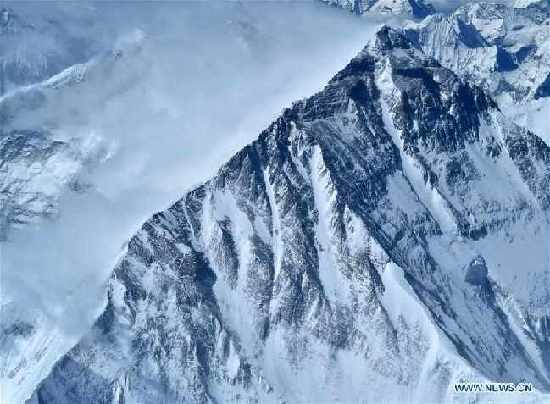
BEIJING, July 3 -- China has completed the first-ever high-precision airborne gravity survey for Mount Qomolangma and its surrounding region recently. The indigenous surveying and mapping instrument that facilitates this survey is a new-generation strapdown airborne gravimeter independently developed by the College of Intelligence Science and Technology (CIST) under the PLA National University of Defense Technology (NUTD) and the China Aero Geophysical Survey & Remote Sensing Centre for Land and Resources (AGRS) under the China Geological Survey (CGS). It is also the first gravimeter and data processing software of its kind with independent intellectual property rights in China.
Since 2003, the CIST and the AGRS have begun to cooperate in developing a strapdown airborne gravimeter. After years of independent research, three generations and four types of gravimeters have been developed.
Airborne gravity survey is conducted in the air. With instruments like the gravimeter being installed aboard, the aircraft flies a pre-designed survey line to obtain the gravity data value of spatial location points where it has passed.
In the elevation measurement of Mount Qomolangma, the airborne gravity survey can provide wide and high-precision data effectively and achieve a geoid measurement of centimetre-level accuracy, thus contributing to a more precise measurement of the height of the world's highest peak.